A request that this article title be changed to Thayetkon (24°20′N 95°19′E) is under discussion. Please do not move this article until the discussion is closed. |
Thayetkon | |
|---|---|
Village | |
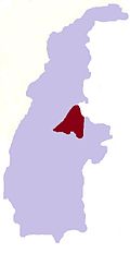
 Thayetkon Location in Burma | |
| Coordinates: 24°20′N95°19′E / 24.333°N 95.317°E | |
| Country | |
| Region | Sagaing Region |
| District | Katha District |
| Township | Banmauk Township |
| Time zone | UTC+6.30 (MST) |
Thayetkon is a village in Banmauk Township, Katha District, in the Sagaing Region of northern-central Burma.[ citation needed ]